.png)


.jpg)
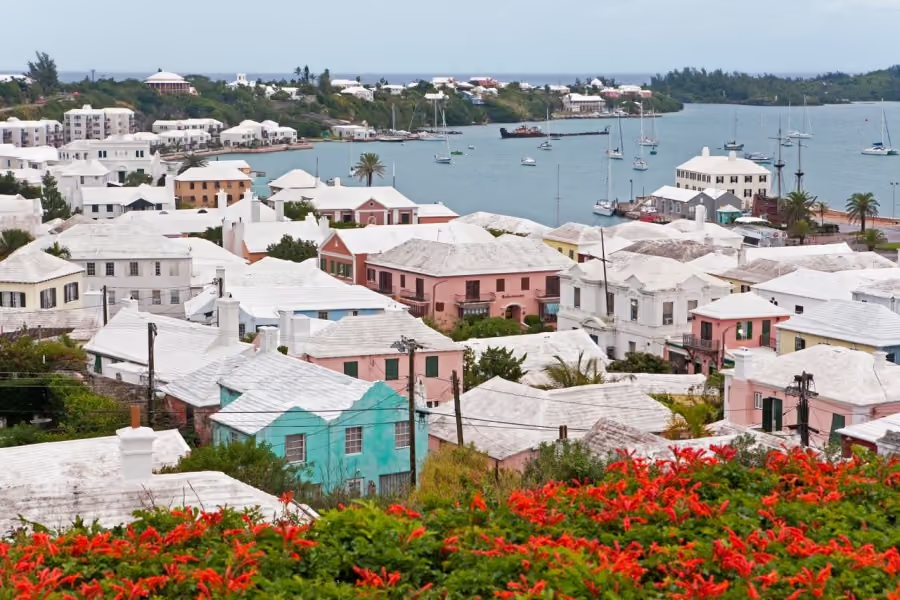
The propogandized vision of the Caribbean with its blue waters and white sand beaches conceals the violent origins of most of our islands — explosive and devastating volcanoes that simultaneously destroy as they create new ecosytems, societities and cultures. In the height of the COVD-19 pandemic, St Vincent and the Grenadines had to coordinate the evacuation of almost 20% of its population after the eruption of La Soufrière in the northern part of the island.
With the last eruption occuring in 1979, an entire generation of popular knowldge and cultural understanding of volcanoes was lost. With volcanic activity resuming in 2019, the state, non-state actors, and communities had to relearn living with volcanoes, relearn their science and relearn how to survive their explosions. What did this process look like in a digital age, where anyone can claim expertise and amass a following, where political divisions are exacerbated in online spaces, where consipiracy theories grow with societal distrust?
In this conversation, we spoke with Nadia Huggins, a visual researcher and photographer from St Vincent and the Grendadines about the exeperince preparing, living through and documenting the 2021 volcanic erruption of La Soufrière.
Nadia Huggins: I am Nadia Huggins, a visual researcher based in Saint Vincent and the Grenadines. I work mainly with photography, although recently, I've been doing more installation and video work as well. In the past decade, I've had a particular interest in ecological themes, although it's not unique to that. I consider my practice somewhat amphibious in nature, as I do work both on land and in the water. I look at ecological concerns underwater but also explore the poetics of the sea. Because I live on a Caribbean island, I am exposed to many forces of nature, from hurricanes to volcanoes, and I document everything to create a record for future generations.
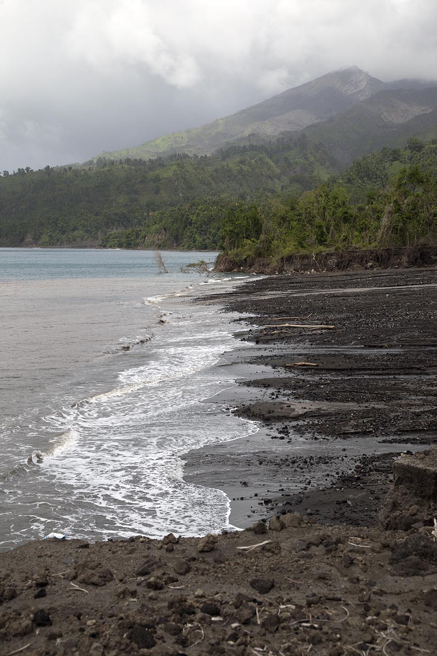
Your work also challenges how Caribbean landscapes are traditionally represented. Volcanoes have left St. Vincent and the Grenadines, with black sand, which is really counter to the external perception of the Caribbean's pristine white sand beaches.
NH: As everyone knows, tourism is a byproduct of the abolition of slavery and is therefore associated with efforts to find innovative ways to support the emerging Caribbean economy. As a result, we have all been quite exposed to the imagery of what the ideal tropical life looks like. It's always been an image of a white sand beach. We never picture a black sand beach. There has always been a push for this propagandized version of the Caribbean. But it's inauthentic because the Caribbean is so diverse. The chain along the Lesser Antilles is volcanic, so most of the islands here have black sand, with the exception of Barbados, which is limestone. But the Caribbean has a general mix of white and black sand beaches.
Visually, I don't see one as more valuable than the other. Part of my work has been to shift the focus from that type of imagery and demonstrate to others that this is quite beautiful too, you know. It has a role to play in the environment. A lot of the coral along the area of the volcano is thriving too. I'm certain that the ash has had an impact on that. We have to try to find ways to place equal value on things. I am passionate about challenging ideas of what is valuable in our ecosystems.
The volcano in St. Vincent and the Grenadines last erupted in the 1970s and then became active again in 2019. What was it like for people to witness the volcano erupting after such a long period of dormancy?
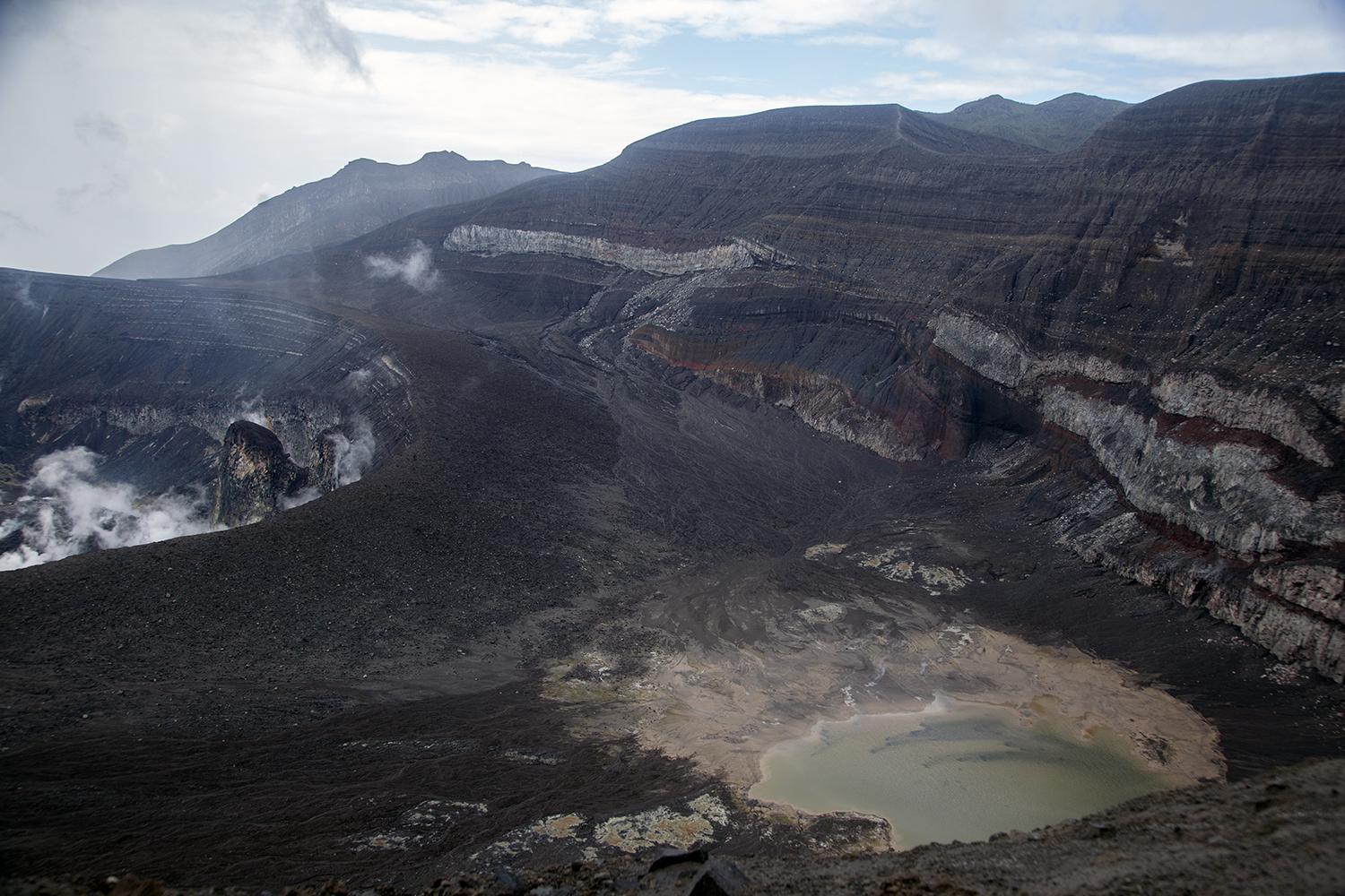
NH: The last volcanic eruption was in 1979, so there has been an entire generation of people who would have passed on. A lot of knowledge was not handed down during that time, but it's always been something that we're always obviously conscious of. If you drive to the northern side of the island, the volcano is quite prominent, and it has an ominous presence to it. In 2021, when the volcano began erupting, magma started to form inside the crater, like a very small mound. It just grew into what looked like a giant roasted breadfruit.
The pressure built up, the magma solidified, and then it started to explode. Technology has obviously changed so much since the last eruption in ’79 1, and being able to witness something like that in real time had a profound impact on our consciousness. The people in the vulnerable areas who had received some training leading up to that moment knew how to evacuate their communitieis. Overall, we didn't have any fatalities directly associated with the actual eruption. I assume people may have developed other [health] issues tied to the eruption outside of that.
What did disaster preparedness in St. Vincent and the Grenadines look like leading up to the eruption?
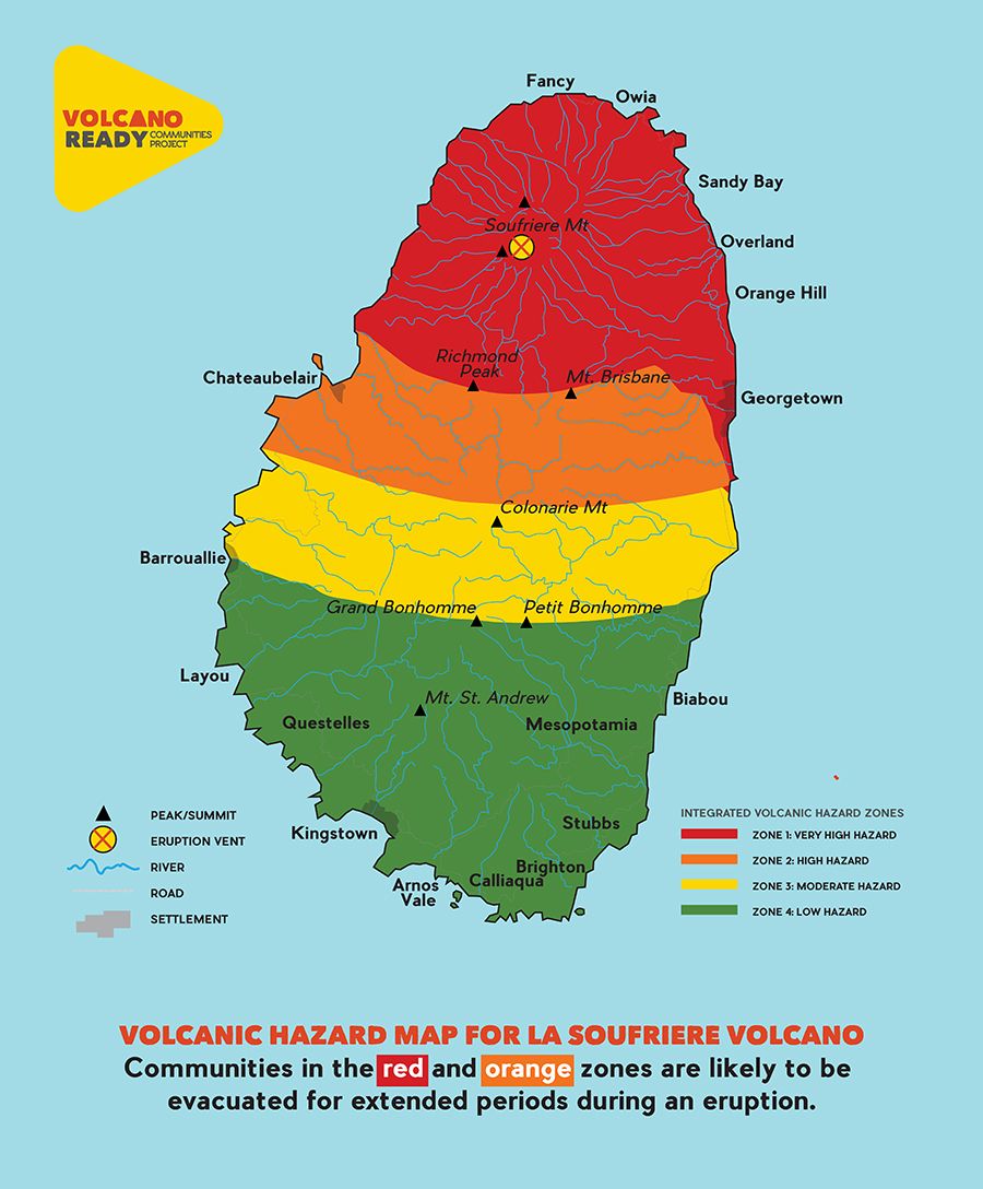
NH: The National Disaster Agency had its strategy for educating the public at that time. I was hired by the UWI Seismic Research Department in 2019 to build some of the visual material to educate communities. I helped with detailing hazard maps, pinpointing shelter locations, and highlighting what routes to take once the disaster hits. The maps included:
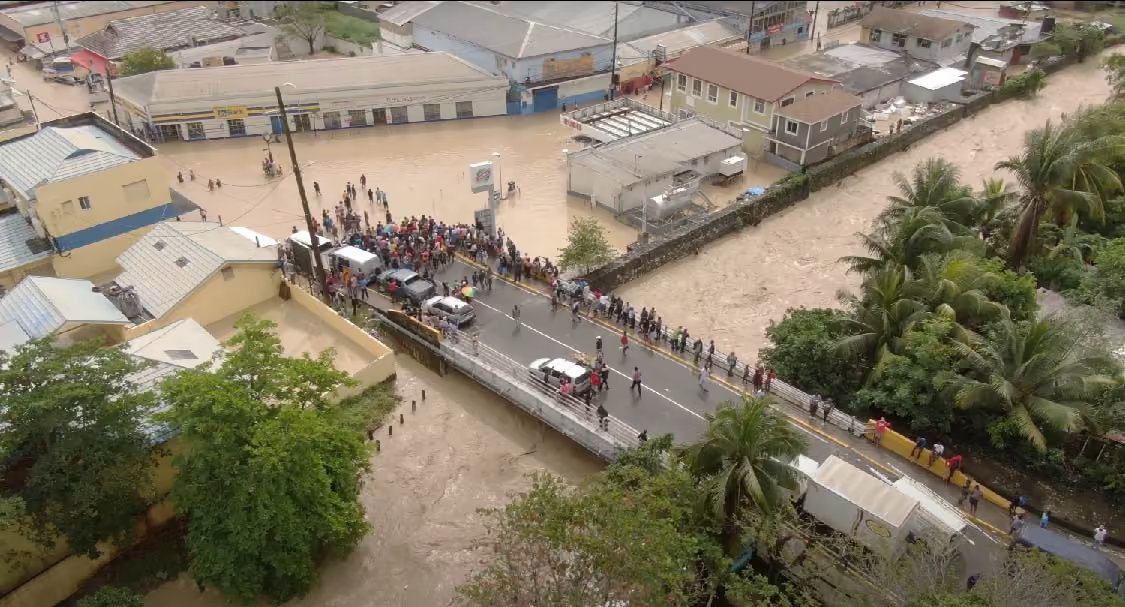
This visual material was embedded in the consciousness of people, which made a difference. The seismic research department also has a media campaign to educate the public on volcanoes. They teach about the types of volcanoes that exist in St. Vincent versus Montserrat, for example, and how age impacts how it erupts. A younger volcano would have more lava flows rather than an older volcano, which erupts with higher ash plumes, known as pyroclastic flow, making it more explosive. Once that hot ash and stone start coming down the hill, otherwise known as the “red zone”, it is impossible to outrun. It’s also important to be aware of what happens after the eruption, because once it starts to rain, all the ash deposits come down the river channels. This entirely changes the pathways of rivers.
It impacts the land in more insidious ways than you might imagine. It’s not just the initial explosion; it is an ongoing process that changes the path of everything. The public was being educated about that from 2019 right up to 2020, when the eruptions started. I think all of this was enough to make a difference in saving lives. It could have gone in a very different direction.
How did the COVID-19 pandemic complicate both the practice and the actual evacuation when the eruption began happening in 2020?
NH: The government mandated vaccinations to access the community shelters, but many simply refused. The government couldn't deny the general populace the right to be in these public shelters. So, many residents responded by opening their private residences to others. Overall, the shelters were heavily occupied for many months. Some people were eventually able to go back to their homes. But a lot of residents on the North Windward side of the island, close to rivers, lost their properties.
Songs about hurricanes like “Wild Gilbert” have embedded themselves in Jamaican popular culture, how has the volcanic eruption made its way into the popular culture of St. Vincent and the Grenadines?
NH: We heard many stories of the aftermath. Some are hilarious, of course, but you can feel the trauma wrapped up in it all. There are a few quotes that resonate deeply within our cultural memory. One of my favourite anecdotes involves a man on the mountain during the eruption who urgently sought shelter in a shed. Once inside, he cleverly fashioned his T-shirt into a head wrap for protection. He later demonstrated how he secured it around his head, which we found quite amusing. During the chaos, he was calling out to his friend Shabba, a name that has since become synonymous with the volcano in our collective memory. Now, whenever we hear ‘Shabba,’ it instantly evokes thoughts of that volcanic event.
There is another story of a woman who rhythmically chanted “Boom. Boom. Boom” amidst the eruption. It’s fascinating to observe the sounds people create in such moments. I have heard of something similar in Haiti with their earthquake. They used a kind of phonetic sound to reference the reverberations. That is a Caribbean way of communicating these moments. When people talk about the volcano, it tends to be more humorous. It’s less about reliving the trauma of it. I think generally, as Caribbean people, we don't seem to get too deep into the emotional, painful aspects of things without lacing it with some humour. That just seems to be our coping mechanism.
People have written songs too, and there's a lot of art being made about the occasion. I'm sure that some Calypsonians have made references to the volcanic eruption, but usually when Calypsonians speak about these events, it's from a political standpoint. The people living in the vulnerable communities— mainly the indigenous communities, the Garífuna and Kalinago— mostly live close to the volcano. I am sure they have their ways of remembering and telling. Quite frankly, I don't even know if most of us have access to that knowledge.
NBC SVG. (2021). Vincy Power: 2021 volcano tribute song for St. Vincent & the Grenadines (official video) [Music video]. Facebook.
Post-eruption, what were some of the very visible ecological transformations?
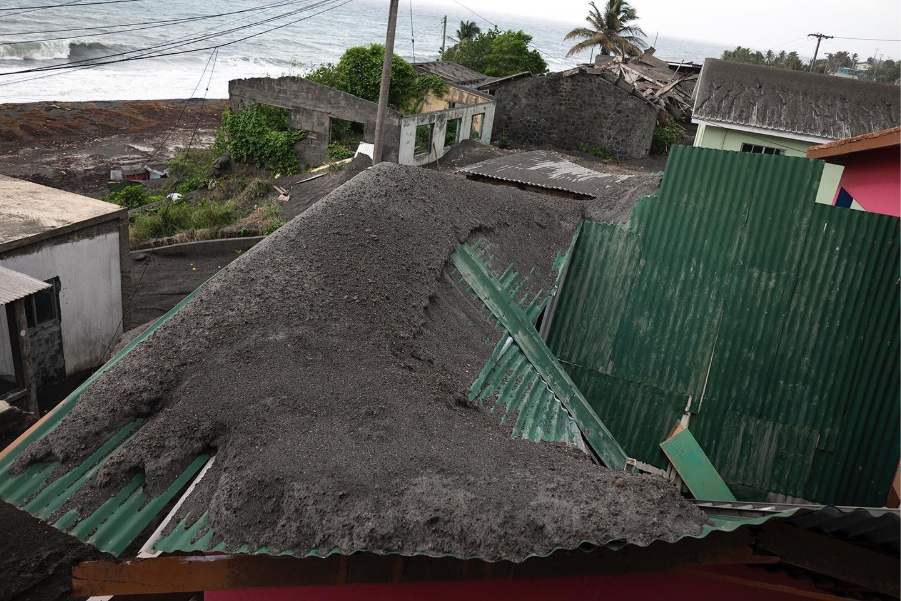
NH: The first apparent thing is the sandy volcanic deposit. We have had whole new beaches come into formation and others have naturally expanded. This is likely a result of volcanic materials flowing down from the rivers or carried in the air and settling in one place. The amount of sand that was essentially being redistributed astounded us. Plants like coconut and palm trees were more vulnerable to the eruption. Coconut trees are often a sign of a disaster's effects on a community. After hurricanes, coconut trees are wind-lashed, but with a volcano, the coconut tree looks like a skirt.
Another transformation is the impact on people's homes. After twenty days of consistent explosive eruptions, the scale of the sand was overwhelming. After each eruption, you saw people sweeping the debris off their homes and property, but according to the seismic research department this was equivalent to sweeping sand off a beach. It was very disheartening; every time there was another eruption, we had to attempt cleanup again. When it eventually rained, the volcanic material calcified into a cement-like material, so it eventually became very difficult to do anything.
What role did the state play in providing resources to help people recover after the volcanic eruptions?
NH: I don't think the government was prepared personally, and they have received countless criticisms from evacuees. Their role was to provide shelters, food, etc. But they didn't even have mattresses in the shelters. The Seismic Research Centre conducted an inventory check prior to the eruption, which proved that the government had adequate resources. But the government politicized the distribution of resources. Only supporters of the government got access to many needed items, and many of the homes that were even rebuilt were for party supporters.
Community members had to activate their own fundraisers to buy mattresses and water. Also, World Central Kitchen visited the island and was able to provide food for people quite consistently. The indigenous communities are very resentful of the government for not doing what they were supposed to. Additionally, we have no idea what happened to the funding that came to the island. We had elections shortly after the eruptions, and many of us wondered where the government officials received all these campaign funds from. They have been completely non-transparent with absolutely zero accountability. I don't know what the solution to all of this is, but I think it comes down to the fundamental understanding of a country's values and needs beyond politics [1]. It's devastating, and it really builds a lot of mistrust. Right now, many of us are buying our own generators and other emergency supplies for the next disaster. We do not want to be dependent on the government for anything.
Images of hurricanes and volcanic eruptions are visually dramatic – they are spectacles. In Jamaica, after Melissa, these spectacles when combined with distrust of the state melted into these ecological conspiracies about lab-made hurricanes. As a photographer, how do you balance the spectacle of photographing a natural disaster with the responsibility to provide scientific context that helps people understand what they are seeing?
NH: At the core, there is a general mistrust of the government. Many people believed that the geothermal plants built on the volcano had triggered the eruption by releasing pressure beneath the surface and triggered an eruptio [2]. I think the public was trying to find a rationale for this inexplicable thing that was so traumatic. Sometimes it's just easier to blame the government than to understand it's a natural unfolding of events.
For instance, there was this one guy; we called him ‘Lava Man’; he is quite a character! During the eruption, he claimed that the scientists didn’t know what they were talking about. So he decided to go up to the volcano himself to take videos and live stream it across Facebook and Instagram. Especially since the information coming from the scientists was delayed by a day or so, he made it a point to go up and capture it all in real time. However, the volcano was closed off, except for scientists who were permitted to go up. But Lava Man was adamant that he was going to ascend the volcano. He literally climbed it and descended into the crater where the magma was rising. He streamed everything live, too. The authorities had so many issues with this guy! They were trying to get him out safely, even during the explosions, which happened a day or two after he went up. The public loved it, though; they praised him as someone brave.
Rodriquez, Desron (@desron_rodriquez). (2021). Lava Man on top of La Soufrière volcano during the 2021 eruption. Video originally published on Instagram
Potentially, scientists are also speaking in a way that people just can't understand or relate to. But Lavaman is stepping into that gap with his translation of the events as they unfold. How correct were his assessments of the situation?
NH: He definitely provided a visual record of what was going on in real time. For a while, the scientists installed a camera on the crater, but it was destroyed by the first eruption. Lavaman was in the thick of it all after climbing the volcano, so he was able to gather information that they would not have obtained unless they had made a very specific visit.
I think there was some value in what he had to offer. But the way he was doing it was irresponsible. He basically communicated to the public, “Hey, if I could do it, anybody could do it.” So, of course, along came a lot of young, bravado men during the eruption trying to scale the volcano. It was irresponsible. I think if the scientists had found a way to work with him more closely and responsibly, it could have been different. But he didn't want to take orders.
I think, in order to avoid more situations like this, there has to be a change in the way information is communicated to the public. I understand that they have to present scientific facts for their own kind of records, transparency, and archives. That might be useful to them, but it might not necessarily be useful and accessible to everybody. If there's a way to kind of bridge the gap between both, that could greatly encourage more of a general compliance.
How do you navigate the pressure to capture the most dramatic or extreme images, particularly when those images can attract attention and generate income, but may also risk objectifying, or stripping dignity from the people experiencing the disaster?
NH: I think it boils down to an ethical understanding of photography and where the boundary is. When you see something happen, I understand the urge to photograph it. Your first thought might be, “Somebody needs to see this.” And of course, somewhere along the way, you might also think, “Oh, I’m going to get a lot of views if people see this.” It feeds into the ego a little bit. But making ethical decisions in photography requires you to stop and think for a few extra seconds about what your agenda is in that situation. Am I taking this photo to raise awareness, to help bring in funding and support for people? Or am I doing it because I want views, and I want people to see me as some kind of hero in a community, saving a family? People have different agendas, and I think it's difficult to change that mindset unless you're really invested in understanding your interactions with people and your own value system.
I’ve been doing photography for a while, and as a younger photographer, I’ve gone into more impoverished communities and taken cliché images, like a guy standing in front of a rum shop. Those images are easy to take because, technically, in terms of subject matter, texture and colour, they’re going to look a particular way and get a certain reaction. But at some point, you need to ask yourself: Does this person actually want me to take this photo? What kind of interaction am I having with my subject? What am I trying to achieve, and what is the outcome of that image?
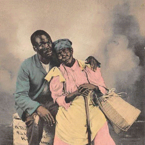
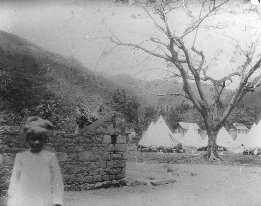
I did a photography exhibition with the Seismic Research Centre with all the archival images of previous eruptions. I found that, in 1902, there was this volcanologist, Dr. Tempest Anderson, who came to St. Vincent and Martinique to document a lot of the landscape. It's the very typical white lens, ethnographic-type imagery of black people sitting on a volcano. Just through my observation or research of his and other images, I decided not to capture photos like that during future eruptions.
So, with the 2021 eruption, I referenced these archival images by reflecting on my personal reality and shooting through that lens. I'm from a privileged class. I don't live in a vulnerable community, and I don't feel like I am entitled to access these spaces to capture that type of imagery. When I went into other communities and photographed the locales, I always did so with a kind of respect. I never photographed somebody unless they actively wanted to be photographed. My agenda was always to try to build a visual archive of imagery that would be useful. Of course, I did take some cliché images of the actual explosion; I photographed these catastrophic, sublime images from a boat much too close to the volcano. But I felt I needed that starting point so I could work backwards from there and build a wider visual reference, something useful that could really communicate what it was like to live through that type of event.

.png)