.png)


As The Bahamas celebrated 50 years of independence in 2023, many festivities marked the occasion, but there was also a need for time to pause and reflect on our development trajectory. So much has happened in half a century, some of which has delayed and even threatened the attainment of a “common loftier goal,” Particularly regarding land use and development. The absence of a documented, common vision for our communities jeopardizes the “Pledge to Excel” that the composer of the national anthem, Timothy Gibson, wrote eloquently about. Thus, we bear witness to a chaotic patchwork of construction, infrastructure promises, and their ensuing problems.
The recent Gladstone Road Improvement Project (GRIP) reveals a pattern of inappropriate and misguided infrastructure development. The government’s investment in this street-to-highway transformation as a singular solution to congestion suggests a lack of awareness about the social, economic, and environmental cost of developments like this and a de-prioritization of alternative investments in public transportation or pedestrianization. How can these risks be taken when we have yet to determine a shared future vision for this community? Given the well-documented failures of road widening projects to solve problems (and create many more), the government should reconsider saddling generations of Bahamian taxpayers with the onerous debt associated with this project.
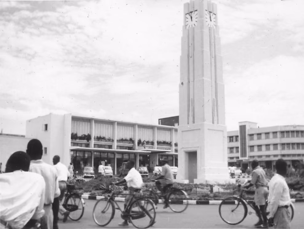
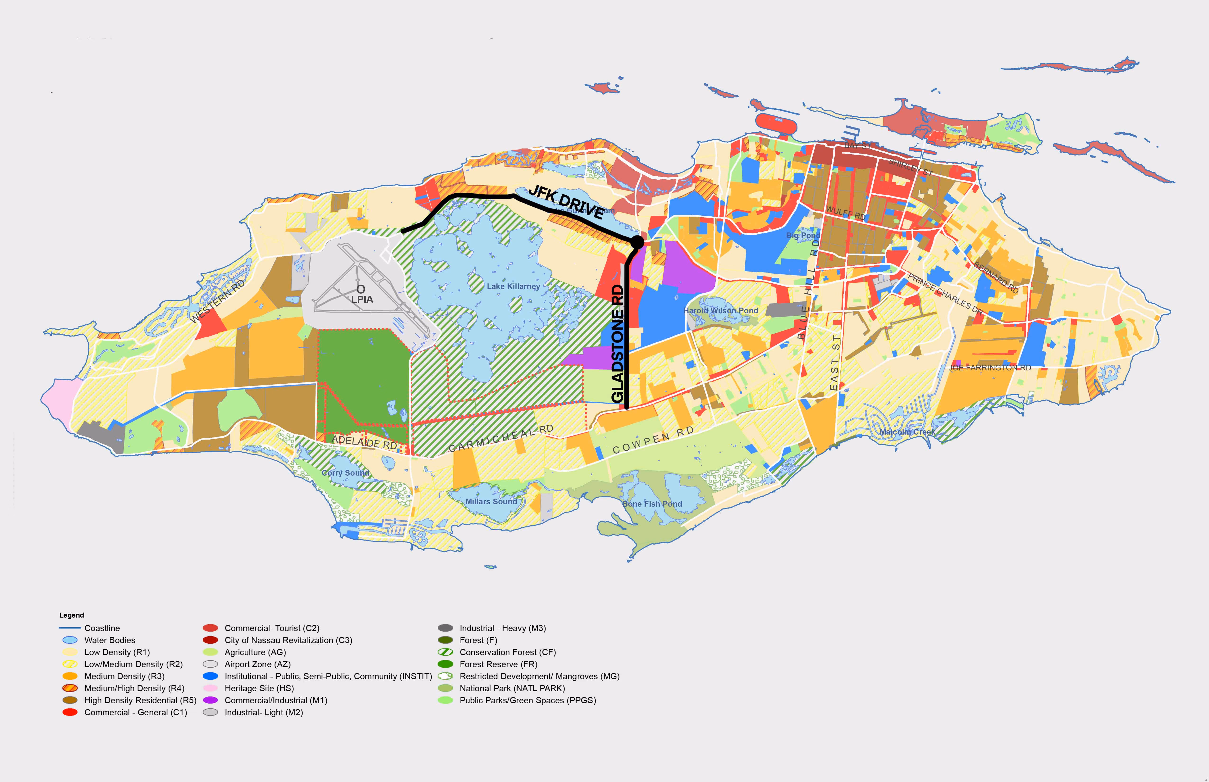
Today, Gladstone Road is a north-south, 2-lane thoroughfare situated at the heart of the island of New Providence and west of the nation’s capital, Nassau. At approximately 3 miles long, it serves as the primary route to the major industrial and logistics centre north of the island. It is adjacent to agricultural lands, wetlands, and, further to the west, Lake Killarney.
Over the last few decades, as Nassau expanded west, the area has rapidly increased its residential population with several housing subdivisions along the East side of Gladstone Road. With residential uses dominating the area, commercial and retail uses have followed, shifting the area into an emerging, bustling community of diverse residents. On Saturdays, there is a pop-up farmers’ market where you can find local teas, conch fritters, and live music. Further north of the market is a newly built high school, and beyond that, at Gladstone Road’s terminus, there is a cemetery that hosts one or more funerals each week.
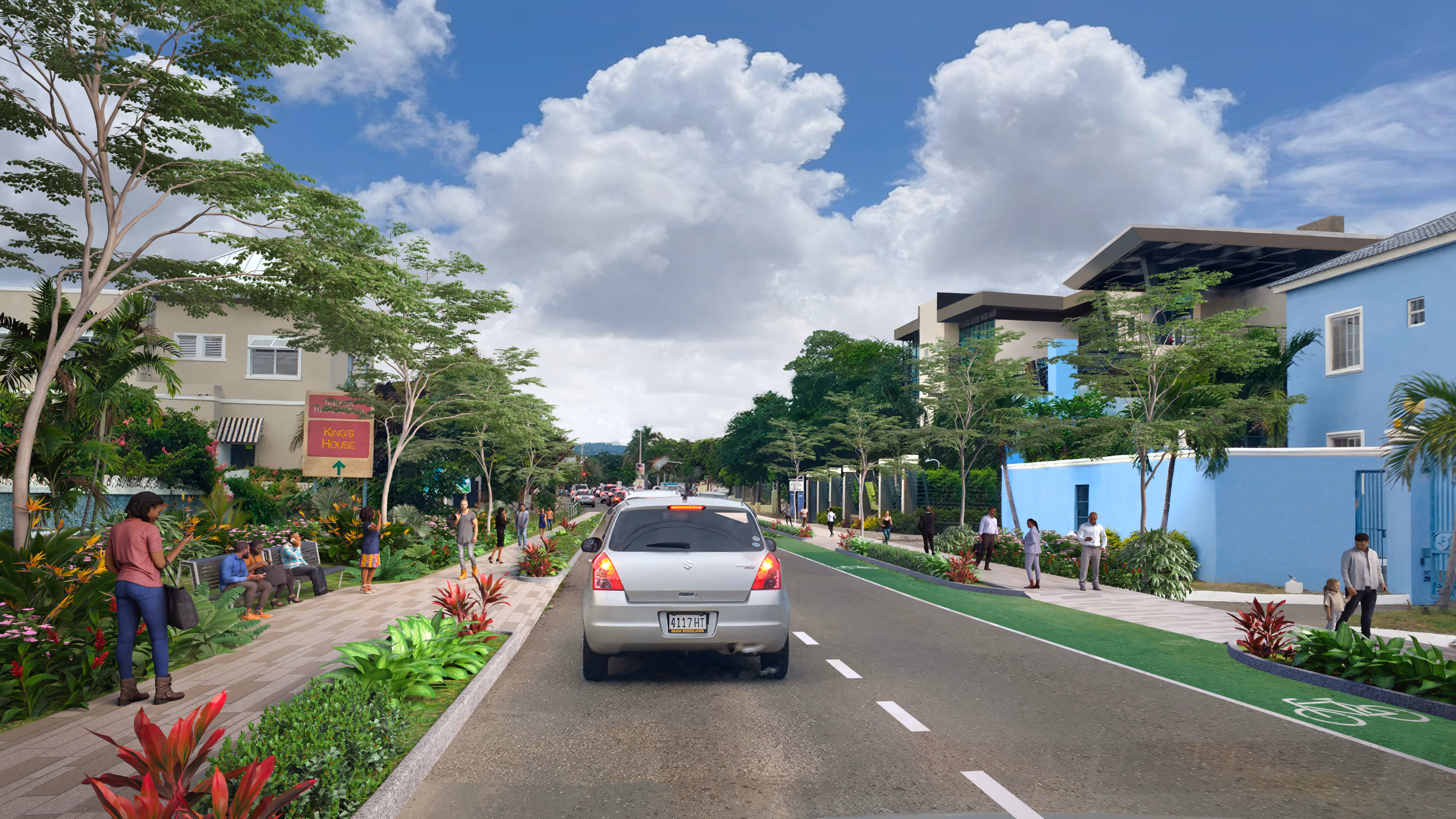
As the population along Gladstone Road has grown, vehicular congestion along the thoroughfare has become a major inconvenience for road users. According to Alfred Sears, Minister of Works and Utilities, “It is an important carriageway, bringing people from the southern part of New Providence to work and school in other parts, and we know that it’s not adequate for the volume of traffic and time is of the essence in terms of getting to work, getting to school and, of course, getting home after work.”. As the singularly proposed solution to the problem, the government is planning to embark upon a massive road expansion that, after completion in late 2025, will replace the 2 lanes with a median-divided highway of 4 lanes (2 for traffic heading north and 2 for those heading south) each 12ft wide. The plan calls for the addition of sidewalks, an adjacent bicycle path, and bus stops. The posted speed limit will be 30mph (~ 50 km), and major, signalled intersections will be replaced with roundabouts, all with the aim of reducing travel times during peak periods.
In many ways, this design nearly mirrors John F. Kennedy Drive, which makes it a suitable local case study. JFK Drive is another major thoroughfare providing direct access to the island’s main port of entry (the Lynden Pindling International Airport), to industrial plants at Clifton Pier and to the residential communities of western New Providence. JFK Drive was widened and converted into a highway back in 2010. The two thoroughfares merge into a common roundabout; however, adjacent land uses and densities make these completely different communities and should be treated accordingly.
Unlike the Gladstone Road area, JFK Drive is less densely populated and is surrounded by lakes and green space. Nearly all its bordering properties use smaller, less busy local and collector roads to the north or south of JFK Drive for direct access. In fact, the only way most drivers can enter is via one of eight roundabouts, whereas Gladstone Road acts as the spine to numerous local, collector and arterial roads extending to the east and west. Another significant difference is that no sidewalks or other amenities along most of JFK Drive would accommodate walking, so pedestrians and cyclists are few.
All things considered, it follows that to insert a JFK Drive-styled highway in the Gladstone Road community, where homes and businesses will be brought even closer to the highway, would be a recipe for disaster. While the posted speed limit is expected to be 35 mph, anyone remotely familiar with road attitudes in New Providence knows that the generous 12 ft lanes will signal to motorists that this roadway facilitates faster speeds, and they will act accordingly. To make matters worse, the plan calls for replacing traffic lights at intersections with roundabouts. This would mean that pedestrians and cyclists must constantly negotiate crossing motorists to get to the other side of the road.
The designs for Gladstone Road are all organized to move motorists as quickly as possible. Highway projects like GRIP make New Providence more car-dependent. Those who can afford the cost of car ownership will simply drive, and many who cannot afford it still take on the financial burden to avoid the hostile pedestrian experience and limited public transportation options (more on this later). In 2010, 3 out of every 4 trips were done by a private car, and in that same year, the number of registered vehicles outpaced the population. As the population continues to grow (by 27% between 2015 and 2040), our investments in car dependency will result in restricted development and dispersed land-use patterns to accommodate the excessive space required for private cars.
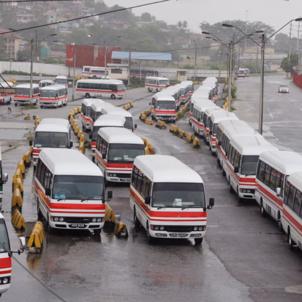
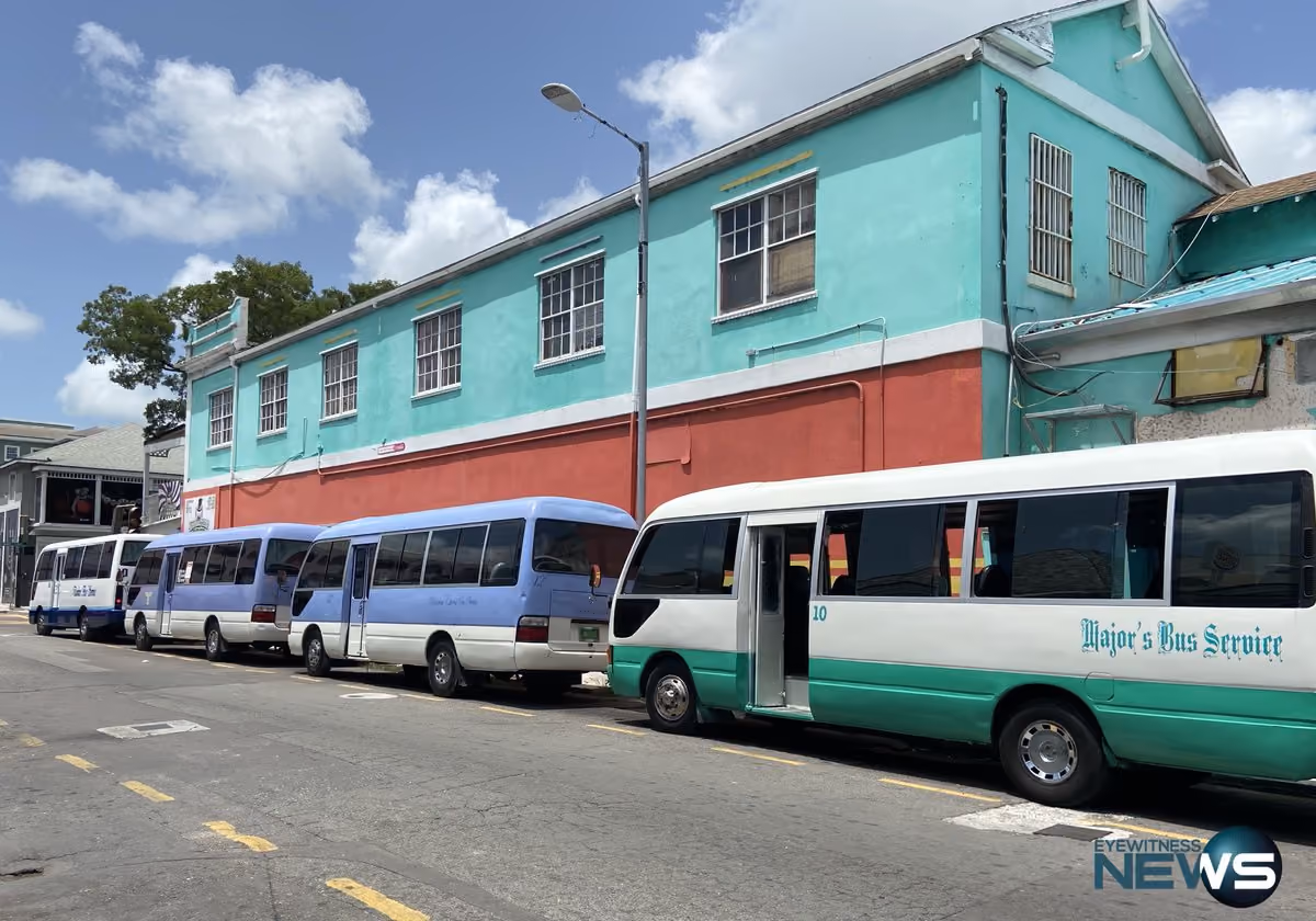
...the funds earmarked for the Gladstone Road widening could have been better used investing in the Jitney system.
Had local conditions been a key factor in decision-making to improve traffic flow along Gladstone Road, mass transit would be centred as the most effective way of moving large numbers of people en masse. Despite its challenges, the Jitney (local terminology for public buses) is a common mode of transport for 60,000 to 90,000 riders each day (TRIBUNE), which amounts to 15-22% of the nation’s population (WORLD BANK) and is ripe for investment.
The government, for years has studied the poorly regulated system with the aim of making improvements. So the funds earmarked for the Gladstone road widening could have been better used investing in the Jitney system. The benefits are obvious: expanding mobility options, increasing the likelihood of persons forgoing private vehicle trips, reducing carbon emissions and pollution, expanded employment opportunities and the reduction or elimination of the perceived need for expensive road expansions.
Any major change to Gladstone Road would be unjustified, given there is no plan that appreciates the interrelatedness of this infrastructure with the wider development goals of this community and, more broadly, the island. This massive infrastructure decision would radically transform this community for just the “promise” of reduced congestion yet ignores the well-documented potential that investments in public transit would deliver, making it a viable alternative to GRIP and more cost-effective. The government would not permit the construction of a home without a blueprint, and yet, standing on 50 years of independence, New Providence (and much of the country) lacks a blueprint to guide the build-out of its physical landscape.
There is a need to devote time and resources to systematically and continuously studying local conditions on the ground, car-dependent American-style urban development patterns are not suitable to our context. Even as the US Department of Transportation pivots away from this practice, the Bahamian Ministry of Works is actively utilizing these very principles to undergird its plans.

Another important concern is the environmental risk associated with the project; it is estimated that up to 8,620 sq ft of existing mangrove forest1 may be impacted by the construction works.
These trees are an important component of the Bahamian ecosystem, creating a habitat for local wildlife and protecting against land erosion, particularly during storms and flooding. This sends a confusing message that undercuts the government’s legitimate and dire warnings to the international community about the effects of climate change on small island nations like The Bahamas.
In order to hedge against the adverse effects of this and future ill-conceived ventures, a comprehensive or master plan is needed to outline the goals and aspirations for the country’s growth and development and how to get there. With such a plan, it would be clear what types of development and infrastructure should be prioritized and what should be avoided for each local community context. Plans like this spell out what the physical landscape would look like, what sort of strategies would best serve the people and how to go about preserving precious natural resources.
The Ministry of Works projects that costs for the Gladstone Road plan will amount to about $USD30 million and has admitted that lack of adequate funding would compel the government to look to transnational financial institutions. Therefore, taxpayers, some of whom will not regularly utilize Gladstone Road, will invariably be stuck footing the bill and the accompanying interest of a project that cannot guarantee congestion improvements.
Most may not consider this in much detail, but every residential or commercial establishment that is built requires a host of basic services and infrastructure to make their presence even possible. They don’t just magically appear, someone has to pay for it, and that typically is the Bahamian taxpayer. Even in instances where the government borrows money from external institutions, they must be repaid by the taxpayer with interest like any other loan. The residential community along Gladstone Road has been growing rapidly, and to assume that individuals, private citizens and small businesses should bear the brunt of expanding the roadway while developers and businesses (particularly large ones) enjoy a disproportionate amount of the benefits is untenable and further supports the argument for why this project should be halted.
Successive governments approve various kinds of large-scale projects, be they major resorts or so-called “road improvement” projects, without an evidence-based, long-range plan in place to guide decision-making towards an established common vision. The Gladstone Road Improvement Project is an expensive promise with no guarantees of success. It disregards local conditions, puts lives at risk and undermines the nation’s campaign against climate change. There’s no reasonable explanation for attempting to fix traffic woes in one place without having a large-scale view of the impacts on the entire island. So, before Gladstone Road and its adjoining community are transformed, a plan that projects 20 to 50 years ahead is needed. Furthermore, instead of committing funding towards a project that disproportionately benefits large enterprises and the construction industry, the GRIP should be swapped in favour of investments in public transportation that benefit all. Only then can we begin to bear witness to Gibson’s vision for a common, loftier goal.